Traveling from Kichik-Alay to Pamir-Alay (through Jiptik pass). Alay mountains. Lenin Peak.
Please contact us to book your tour. The tours start upon your request. The itineraries can be adjusted individually to fit into your schedule and provide you with the best experience. Furthermore, we are happy to create tailor-made tours according to your wishes.
Start at 9 a.m from Osh to Kyzyl-Chara (Kapaly) arrive for lunch in homestay then walk straight away we cross the Kosh-Moinok pass (3220m).as the first acclimatization. Upon reaching the campsite stay tent
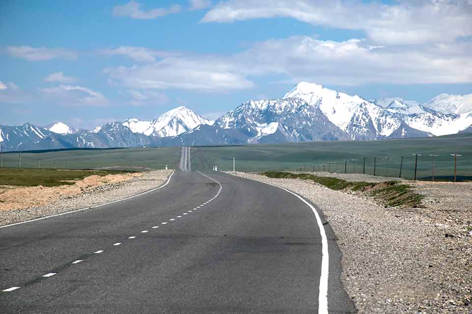
The road from Osh to Kyzyl-Chara (Kapaly) as an absolutely wild zone by nature, for about 4 hours by car, recommended the off-road vehicle. Both sides of the mountains are all covered with green juniper bushes and stretches along the mountain rivers.
The attraction of very steep different rocks surprises the first travelers with canyons, waterfalls and unusual forms of landscape. On the route, you can often meet travelers who love treks and lovers of active travel. This region is different from its unusual houses designs, which built by red and black clay used from local soils and covered with archa firs.
The starting altitude is 1000m.
The Highest walking height up to 3220m
Overnight altitude is 2820m
On this day we will walk up to 4000m on the upper Kosh-Moinok glacier to be more acclimatized. We leave our camp, just take lunch boxes and light things; the route goes up to the glacier then returns on the descent to the same camp.
The starting altitude is 2820m.
The Highest walking height up to 4000m
Overnight altitude is 2820m
3 hours walk up then 2 hours walk down to Kojo Kelen. Trekking through SaryBel pass (3100m) following the path you cross a dense forest of spruce, juniper and marvelous landscape of unusual rocks as well profusion of wildflowers carpeting the mountain path and wild cherry trees mixed with ever-present juniper and other medicinal plants.
The starting altitude is 2820m.
The Highest walking height up to 3100m
Overnight altitude is 2220m
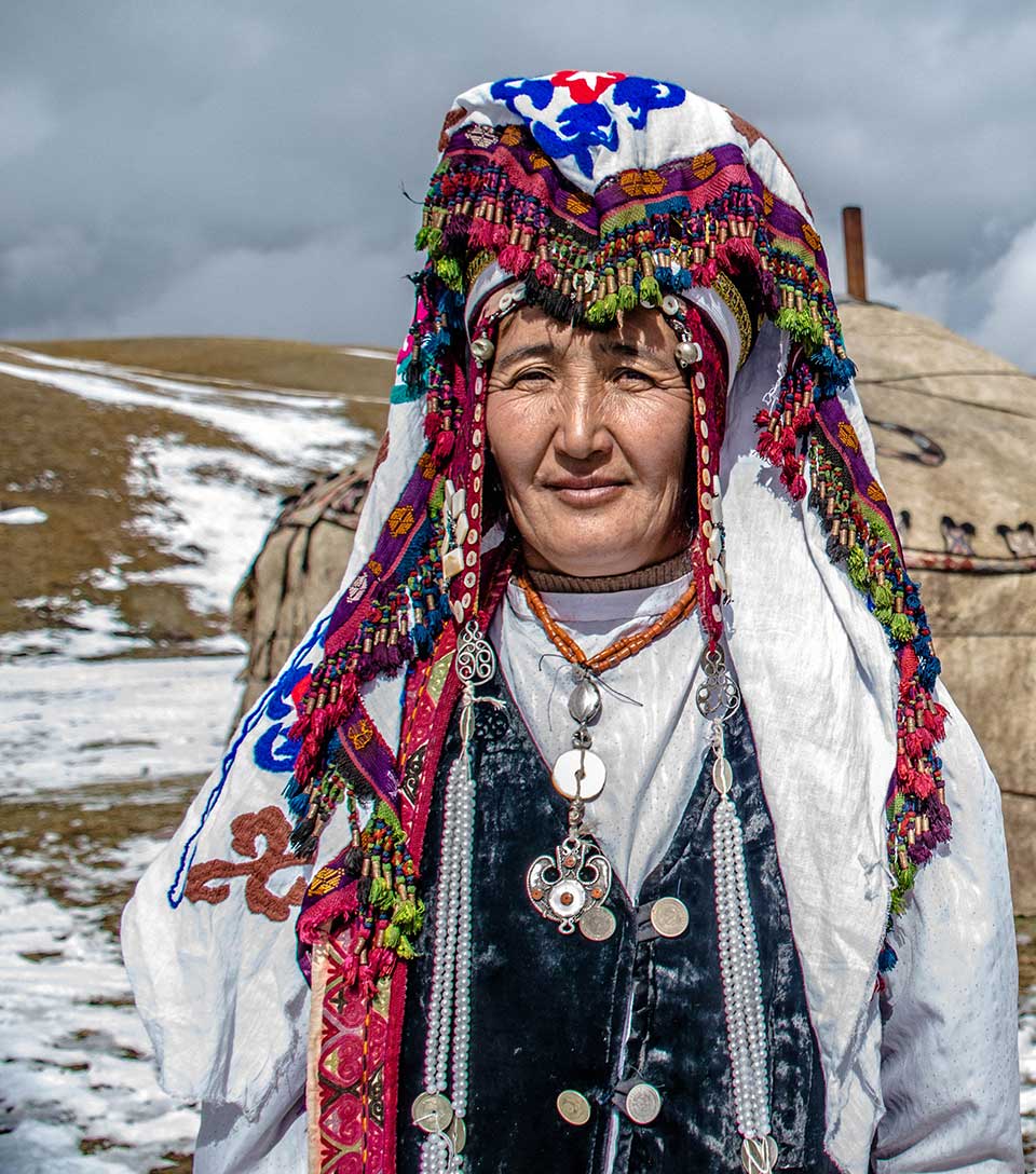
Continue the trek to the yurt, where we will spend the night, passing through a narrow canyon along the Ak-Buura River, have an imperceptible ascent will begin when we approach the pass of all-mountain plants and the recreational mountain landscape are observed. Along the way, we will see only a few yurts of local and herding sheep, yaks, horses, can also be visible as wild animals, marmot, foxes, eagles, and other birds.
The starting altitude is 2220m.
The Highest walking height up to 3040m
Overnight altitude is 3040m
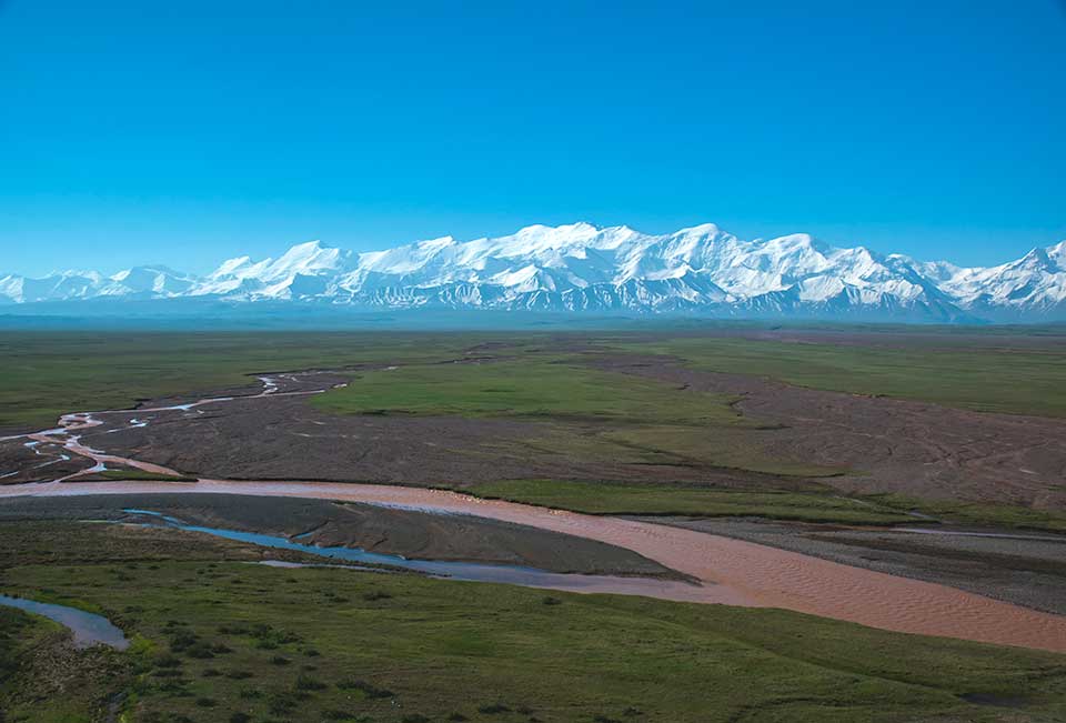
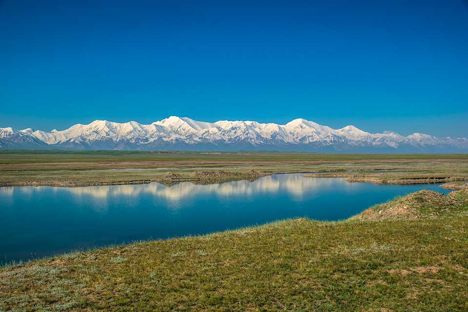
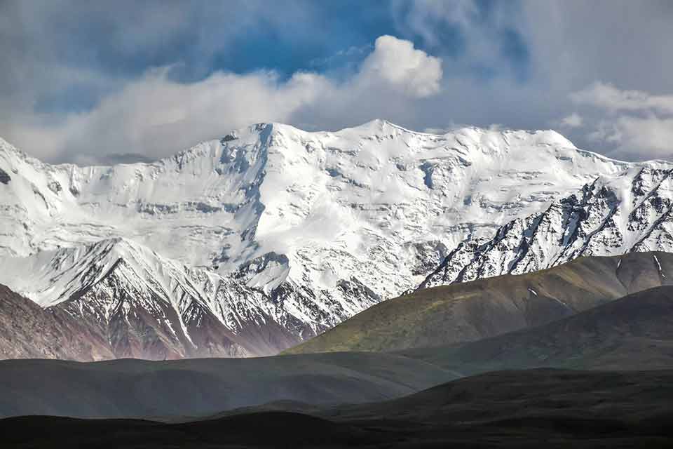
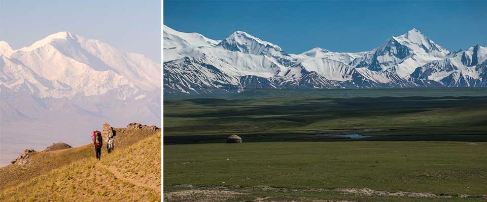
After breakfast, continue to the top of the Jiptik Pass and get there before lunch (4185 m). From the top, you will see a stunning view of the Pamir-Alay valley and the summit of Lenin Peak (7134). If the weather is good, every traveler feels that he has reached the sky. Further down steep towards DarbazaTash. Where the overnight stay will be
The starting altitude is 3040m.
The Highest walking height up to 4185m
Accommodation altitude is 2980m.
As we leaving our camp, we will head for the passage along the grassy slope of the north Sary-Mogol. To be honest on the road we pass through two coalmines so it is not most beautiful after few kilometers, we go to the green pasture surrounding with an unusual form of mountains then we are tempted to climb the grassy slopes and go above the river; the usual trail follows the right. Further, after a few kilometers, we cross again the river to the left and climb the steep slope with a view on the river. This section will probably worry about those who are afraid of heights, but considering that you can be sure of the stability of the path! At the top of the slope, there is a small down section, free and open, here will be our camp just in a few steps.
The starting altitude is 3040m.
The Highest walking height up to 3700m
Accommodation altitude is 3680m.
The starting altitude is 3500m.
(total 14km walking 6 hours)
The final day, which is so beautiful and so heavy trek. On this day we will walk to the pass then come back with the same trail, we take lunch boxes and warm clothes because of unstable weather, we will leave the rest of the unnecessary things in the same camp. One of our guides looks behind the left things, and the main guide accompanies you up to the passage. we need very good trekking boots because the path is very narrow and stony.
our final view ends from the top of the pass from where we can see a panoramic view of the Besh-Kol Lake
Besh-Kol is a rock lake that flows into one another before entering a cavern, situated beneath SaryMogol Pass (4300m). The scenery of Besh-Kol is wild and untouched, with a wide array of wildlife including indigenous mountain goats.
We can get to the pass during lunch then break and you have enough time to inspect all destinations. Return to the camp, then go back to the camp further to the car and transfer to the Sary-Mogol village.
The tours start upon request, please contact us. The itineraries can be adjusted individually to fit into your schedule and provide you with the best experience. Furthermore, we are happy to create tailor-made tours according to your wishes.
After having solved all the questions and programs confirming we issue an invoice for payment. You can make a bank transfer or pay upon your arrival time in Bishkek before the trip starts.
The price of the tour depends on the number of people and the season. According to the request and interest, we can negotiate the optimal price for your budget.
Trekking optional may request some prepared training. The altitude is high and you will cross the high pass Jiptik passes (3040m). We recommend you train with sport or jogging 2-3 times a week in the run-up to your trip.
If you take a horseback riding option you need advanced horseback riding skills. Take a horse riding class several times for getting prepared to ride a horse in the mountains for 4-5 hours every day.
Tent/mat we provide you for the trekking. Clothing for hiking in temperatures from +25C to -0C. A detailed kit list will be sent to you when you book on.
Overnights during the activity tours you will be camping in a tent. Sary-Mogol village offer homestays. Tulpar-Kul is the yurt camp
We provide you with mineral water where it is available to buy on the way in the village shops when we travel by vehicle. In fact, will have bottled water for two first days. But during all trek-days, we will not able to carry the much mineral bottled waters, we take water from the springs and rivers for cooking and for tea-coffee after well boiling for sure. For drinking, you can use water filters. We offer you to bring the water purified pills from your side. In Kyrgyzstan, people used to drink from the rivers and spring source and we don’t use the water filters and any pure file pills. Therefore, you will not able to find the water pure file pills or portable filters in Central Asia at all.
The most international flight focused in Bishkek but Osh is also may have international flights from Turkey. From Bishkek to Osh we have a regular domestic flight (www.airport.kg) which takes one hour flight or take a public share taxi Bishkek – Osh (takes 8-9 hours driving).
The basic hints for travelers.
Kyrgyz Republic. Bishkek city
Mon – Sat 9.00 – 18.00 Sunday CLOSED
© Kyrgyzstan tourism